Difference between revisions of "HighwayFallen (EU2012)"
Jump to navigation
Jump to search
(edits and added images of the entire map) |
m |
||
| Line 1: | Line 1: | ||
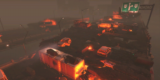
[[File:HighwayFallen.png|frame| loading screen]] | [[File:HighwayFallen.png|frame| loading screen]] | ||
| − | + | '''Missions''' | |
* Council (Extraction - UN General Peter Van Doorne) | * Council (Extraction - UN General Peter Van Doorne) | ||
* Terror Site | * Terror Site | ||
| − | Notes | + | '''Map Dimensions''' |
| + | * Length: tiles | ||
| + | * Width: tiles | ||
| + | * Height: 4 tiles | ||
| + | * Total map area: tiles | ||
| + | |||
| + | '''Notes''' | ||
* The elevated far end of the map is often used by the aliens to shoot at the fallen segment below. | * The elevated far end of the map is often used by the aliens to shoot at the fallen segment below. | ||
* The fallen segment has few full cover spots. | * The fallen segment has few full cover spots. | ||
Revision as of 16:37, 16 January 2013

loading screen
Missions
- Council (Extraction - UN General Peter Van Doorne)
- Terror Site
Map Dimensions
- Length: tiles
- Width: tiles
- Height: 4 tiles
- Total map area: tiles
Notes
- The elevated far end of the map is often used by the aliens to shoot at the fallen segment below.
- The fallen segment has few full cover spots.
- On the Extraction mission the General will be located on the fallen segment, by the jeep.
.png)
.png)